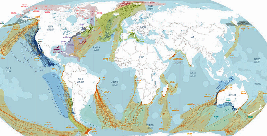
GLAND, Switzerland, February 20, 2022 (ENS) – An in-depth new map and report that tracks whale migrations around the globe, highlights where the whales go in the high seas and the cumulative impacts they face has been issued by the World Wildlife Fund, WWF, to mark this year’s World Whale Day, February 20.
The report, “Protecting Blue Corridors,” was developed through collaborative analysis of 30 years of scientific data contributed by more than 50 research groups, with marine scientists from Oregon State University; the University of California, Santa Cruz; the University of Southampton and others.
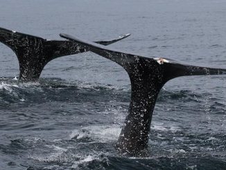
The map provides a visualization of the satellite tracks of 845 migratory whales worldwide. The report outlines how whales are encountering multiple and growing threats in their critical ocean habitats – where they feed, mate, give birth and nurse their young – and along their migration superhighways, or blue corridors.
The cumulative impacts of human activities are creating a hazardous and sometimes fatal obstacle course for the marine species, warned Chris Johnson, the global lead for whale and dolphin conservation at WWF.
“The deadliest by far is entanglement in fishing gear – killing an estimated 300,000 whales, dolphins and porpoises each year. What’s worse, this is happening from the Arctic to the Antarctic,” Johnson said.
After centuries of commercial whaling, six out of the 13 great whale species are now classified as Endangered or Vulnerable by the International Union for Conservation of Nature, IUCN, even after decades of protection from commercial whaling, which ended formally in 1986.
But despite an international ban on commercial whaling since then, whales are still being hunted and killed across the world’s oceans. For a history of commercial whaling and the International Whaling Commission, click here.
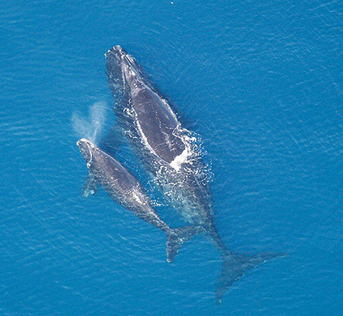
Among whale populations most at risk is the critically endangered North Atlantic right whale, a species that migrates between Canada and the United States. This species is at its lowest point in 20 years – numbering only 336 individuals – a decline of 30 per cent over the past 10 years, the researchers learned.
About 86 percent of identified right whales are estimated to have been entangled in fishing gear at least once in their lives. Between 2017 and 2021, 34 North Atlantic right whales died off the Canadian and United States coasts from ship strikes and entanglement in fishing gear, according to the new analysis.
“Contributing years of data from Oregon State’s satellite tracking studies, pioneered by marine mammal researcher Bruce Mate, we see migrations across national and international waters creating conservation challenges for populations to recover,” said report co-author Daniel Palacios, an endowed associate professor in whale habitats with Oregon State University’s Marine Mammal Institute at the Hatfield Marine Science Center on Oregon’s coast.
The institute is part of Oregon State University’s College of Agricultural Sciences; Mate, now retired, is the former director.
An expert in the study of whale movements in relation to environmental conditions and human threats, Palacios’ contribution to the report centered on the eastern Pacific Ocean.
“For a report of this nature, it was necessary to incorporate the data and expertise from many colleagues doing similar work in other parts of the world,” he said. “For the first time, we were able to map whale migrations on a global scale and identify their superhighways,” Palacios said.
“This map will become an essential ocean variable for a number of efforts working toward assessing changes in biodiversity and will inform critical policy initiatives like the upcoming Treaty for the High Seas under the United Nations Convention on the Law of the Sea,” he said.
“Protecting Blue Corridors” calls for a new conservation approach to address these mounting threats and to safeguard whales through enhanced cooperation on local, regional and international levels.
Of particular urgency is engagement with the United Nations, which is set to finalize negotiations on a new treaty for the high seas in March under the UN Convention on the Law of the Sea. If adopted, a high seas treaty could protect biodiversity in areas outside national Exclusive Economic Zones and allow for the creation of marine protected areas on the high seas.
Ari Friedlaender, a whale ecologist from University of California, Santa Cruz, and previously an associate professor at OSU’s Marine Mammal Institute, is convinced of the value of the new WWF map and report. “As a researcher, this report provides a visual science-based guide to help inform effective management and decisions to create networks of marine protected areas to ensure whales have every opportunity to thrive,” he said.
“The benefits from protected blue corridors extend far beyond whales. Growing evidence shows the critical role whales play maintaining ocean health and the global climate – with one whale capturing the same amount of carbon as thousands of trees,” according to the WWF report.
The International Monetary Fund estimates the value of a single great whale at more than $2 million, which, WWF estimates, totals more than $1 trillion for the current global population of great whales.
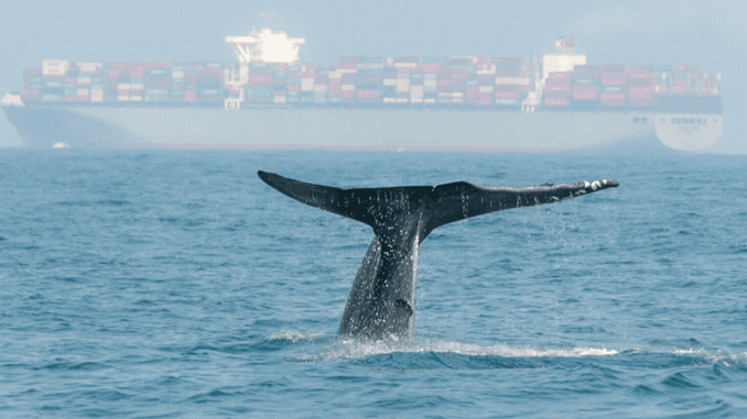
Featured image: Whale migration routes are close to shipping lanes in the Indian Ocean. WWF reports that new fast-ferry links are being planned and established throughout the region. (Photo © SBedaux / iStock used with permission)
© 2022, Environment News Service. All rights reserved. Content may be quoted only with proper attribution and a direct link to the original article. Full reproduction is prohibited.