COLLEGE PARK, Maryland, February 13, 2021 (ENS) – More than 100 million Americans are currently under Winter Storm Warnings, Winter Storm Watches, or Winter Weather Advisories as coast-to-coast stormy winter weather is happening now or is forecast by the National Weather Service.
Icy weather is ongoing across parts of the Mid-Atlantic, continuing through tonight. A major winter storm currently affecting portions of the West will spread heavy snow and ice accumulations to the Plains and eastward early next week.

Frigid Arctic air and dangerously cold wind chills are forecast to persist in the Heartland into next week.
An extensive Arctic high will continue to cause bitterly cold temperatures across much of the Lower 48 states through early next week, and widespread winter weather is forecast along its periphery.
Parts of the Eastern Seaboard are seeing precipitation today into tonight, and sub-freezing temperatures support the precipitation falling as freezing rain and sleet across parts of the Mid-Atlantic.
Ice Storm Warnings and Winter Storm Warnings are in effect across northern North Carolina into much of Virginia, the District of Columbia, and parts of Maryland. Storm total freezing rain amounts could accumulate to a quarter-inch, with locally higher amounts of a half-inch possible, likely leading to downed tree limbs and power outages, as well as dangerous travel conditions.
Ice and freezing rain from the winter storm moving through the mid-Atlantic region knocked down trees and power lines and left tens of thousands of people without power Saturday.
Dominion Energy reported some 130,000 customers in Virginia without power Saturday afternoon. North Carolina officials reported more than 176,000 utility customers without power, most in the central part of the state.
Meanwhile farther south, precipitation should not freeze but remain rain across the Southeast, but rain and thunderstorms could be heavy across parts of Florida and southern Georgia.
Marginal Risks of severe weather and flash flooding are in place today, with a Slight Risk of severe weather in place for portions of Florida tomorrow, with warm conditions south of a stationary front.
Kentucky Governor Andy Beshear declared a state of emergency in Kentucky due to the ice storm that at one point Wednesday left about 70,500 customers in the state without power. No deaths or injuries have been attributed to the storm that hit Kentucky, forcing some road closures and Beshear’s order that state workers, except emergency personnel, stay at home on Thursday.

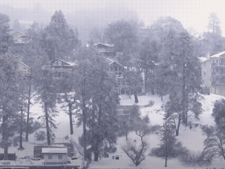
In the West, snowy and icy conditions are ongoing as Pacific moisture interacts with the cold air in place. Even the lower elevations of the Pacific Northwest, including Seattle and Portland, have seen snow with this event. More than six inches of snow fell outside Seattle and Portland, while an ice storm is devastating the region of Oregon south of Portland.
The COVID-19 mass vaccination site at Portland’s Oregon Convention Center is closed on Saturday and Sunday due to the weather, said Oregon Health & Science University. Precipitation may wind down there tonight before another low-pressure system approaches and moves through the West, leading to still more precipitation.
The first wave of precipitation is dropping southeastward through the Four Corners region, at the intersection of four states: Arizona, New Mexico, Utah and Colorado. There, it will combine with some Gulf of Mexico moisture to produce widespread snow across parts of the Central/Southern Rockies and Central/Southern Plains by Sunday, spreading into the Mississippi and Ohio Valleys by Monday.
Near all-time record cold, blowing snow, and accumulations of eight to 12 inches are likely in Oklahoma on Sunday and into Monday. Snow totals of several inches are forecast across much of Oklahoma and into northern Texas, where Governor Greg Abbott Friday issued a disaster declaration in all 254 counties in response to the severe winter weather.
“Travel may become impossible and possibly life-threatening for stranded motorists,” the National Weather Service office in Dallas-Fort Worth warns.
At least six people died and dozens more were taken to hospitals after an accident involving 135 vehicles happened Thursday on a Fort Worth, Texas highway, the worst pile-up in Texas history, and the most serious of the many crashes on icy roads in the area, according to Fort Worth Police Chief Neil Noakes.
South and east of the snow nearer to the Gulf Coast, an icy wintry mix is expected. Significant freezing rain is a threat, and the current forecast shows accumulations over a quarter of an inch across central Louisiana and Mississippi. Snow and ice are then forecast to track into the northeastern United States later Monday into Tuesday.
Beneath the aforementioned Arctic surface high-pressure system, most of the country, especially east of the Rockies, will continue to see dangerous and record-breaking cold into the first part of next week.
The northcentral United States should once again see high temperatures falling below zero degrees Fahrenheit on Sunday, with single-digit highs stretching as far south as the Texas Panhandle. Low temperatures are forecast to be as cold as -30 degrees in the Northern Plains to Upper Midwest. Add in gusty winds and the result is life-threatening wind chills between -30 to -60 in the north-central Lower 48 states. Wind Chill Advisories extend as far south as the Southern Plains.
Hundreds of daily low maximum and minimum temperatures will be broken, with some February and even all-time low-temperature records in jeopardy, according to the National Weather Service.
© 2021, Environment News Service. All rights reserved. Content may be quoted only with proper attribution and a direct link to the original article. Full reproduction is prohibited.