
COLLEGE PARK, Maryland, November 13, 2019 (ENS) – The arctic outbreak that has been gripping much of the central and eastern United States will culminate this morning with more than 100 locations expected to tie or set new low-temperature records.
An early blast of cold arctic air will consume much of the eastern two-thirds of the U.S. over the next few days, making it feel like the middle of winter. Numerous record lows and record low maximum temperatures are expected through Wednesday, as temperatures average 20 to 30 degrees below normal.
The National Weather Service says, “The intensity of this arctic outbreak is comparable to the “Blue Norther” of 1911 in which much of the Plains eastward to the East Coast saw record cold temperatures in the teens and 20s shortly after record warm temperatures of near 80 degrees were observed on the same day!”
At least five people have died on icy roads, including an eight-year-old girl in Kansas. Slick roads caused a 50 car pileup near Youngstown, Ohio, that left two people critically injured, CBS News reported.
Forty miles west in Hudson, several collisions caused cars to spin off the road. Overnight, a bus carrying seven passengers landed on its side after the driver lost control just south of Syracuse, New York.
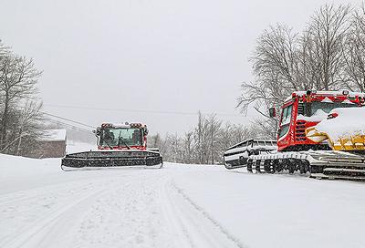
Meanwhile, snowfall records shattered across the Northeast and Great Lakes. In Buffalo, New York, nearly nine inches of snow broke a 77-year old record. Parts of northern Michigan saw upwards of 30 inches of snowfall.
The expansive high-pressure system associated with the current arctic outbreak will begin to move east of New England on Thursday. Temperatures will begin to recover during the day on Thursday after one more morning of record cold temperatures for some locations from the Mid-Atlantic coast to New England.
An upper-level disturbance rapidly moving across the northern Rockies this morning will spread rain and snow eastward from the northern Rockies through the upper Midwest today.
The lake-effect snows currently across the Great Lakes will become more widespread by tonight as the area of snow from the upper Midwest arrives.
The frontal system associated with this disturbance is on the weak side, and the wet snow should move farther east across the lower Great Lakes and northern New England by Thursday night. A secondary cold front will then approach the upper Great Lakes Friday morning, bringing a renewed round of snow into the region.
At the same time, persistent warm and dry weather over the West will continue to elevate fire weather concerns for portions of southern California.
Over the Great Basin/Rockies region, warmer and drier conditions are expected to prevail which will maintain an increased risk for the spread of wildfires.
Farther to the south, an upper-level disturbance arriving from northern Mexico will increase the chance of rain along the Gulf Coast as a coastal front forms just offshore on Thursday.
The rain chances will then increase across the Southeast Thursday night as a low-pressure center is forecast to form along the coastal front just to the south.
Copyright Environment News Service (ENS) 2019. All rights reserved.
© 2019, Environment News Service. All rights reserved. Content may be quoted only with proper attribution and a direct link to the original article. Full reproduction is prohibited.