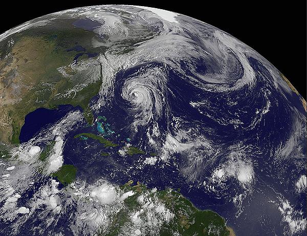
SILVER SPRING, Maryland, June 1, 2025 (ENS) – On the first day of the 2025 Atlantic hurricane season, above-average Atlantic Ocean temperatures have set the stage, and now forecasters at NOAA’s National Weather Service predict above-normal hurricane activity in the Atlantic basin this year.
NOAA’s outlook for the 2025 Atlantic hurricane season, from June 1 to November 30, predicts a 30 percent chance of a near-normal season, a 60 percent chance of an above-normal season, and a 10 percent chance of a below-normal season.
The federal government agency is forecasting between 13 and 19 named storms with winds of 39 miles per hour or higher.
Of those, six to 10 storms are forecast to become hurricanes with winds of 74 mph or higher, including three to five major hurricanes – category 3, 4 or 5 – with winds of 111 mph or higher.
“NOAA and the National Weather Service are using the most advanced weather models and cutting-edge hurricane tracking systems to provide Americans with real-time storm forecasts and warnings, With these models and forecasting tools, we have never been more prepared for hurricane season,” Commerce Secretary Howard Lutnick said.
“As we witnessed last year with significant inland flooding from hurricanes Helene and Debby, the impacts of hurricanes can reach far beyond coastal communities,” Acting NOAA Administrator Laura Grimm said.
“NOAA is critical for the delivery of early and accurate forecasts and warnings, and provides the scientific expertise needed to save lives and property,” Grimm emphasized.
This year’s hurricane season is expected to be above normal due to a number of factors, including a continuing El Niño/Southern Oscillation, or ENSO.
This recurring climate pattern exhibits changes in the temperature of the surface waters in the tropical Pacific Ocean and includes related shifts in atmospheric circulation. ENSO encompasses both the warm phase, known as El Niño, and the cool phase, called La Niña, of this cycle.
This year, there are neutral ENSO conditions, warmer than average ocean temperatures, forecasts for weak wind shear, and the potential for higher activity from the West African Monsoon, a primary starting point for Atlantic hurricanes. “All of these elements tend to favor tropical storm formation,” NOAA explains.
The latest World Meteorological Organization’s State of the Climate report issued in June anticipates continued ENSO-neutral conditions, with a 70 percent chance of this persisting through June-August and a 65 percent chance through July-September. There’s also a 35 percent chance of La Niña developing in July-September, the UN agency said.
The forecast suggests above-average temperatures are likely across most land areas, with the exception of regions in the interior parts of the Indian subcontinent, parts of Africa, and South America.
High activity continues in the Atlantic Basin, featuring high heat content in the ocean and reduced trade winds. The higher heat content provides more energy to fuel storm development, while weaker winds allow the storms to develop without disruption.

This hurricane season also features the potential for a northward shift of the West African monsoon, and that would produce tropical waves that seed some of the strongest and most long-lived Atlantic storms, NOAA explains.
“In my 30 years at the National Weather Service, we’ve never had more advanced models and warning systems in place to monitor the weather,” said NOAA’s National Weather Service Director Ken Graham.
“This outlook is a call to action: be prepared. Take proactive steps now to make a plan and gather supplies to ensure you’re ready before a storm threatens,” Graham advised.
Hurricane Analyses and Forecasts Upgraded
NOAA will improve its forecast communications, decision support, and storm recovery efforts this season in a variety of ways.
- NOAA’s model, the Hurricane Analysis and Forecast System, will undergo an upgrade that is expected to result in another five percent improvement of tracking and intensity forecasts that will help forecasters provide more accurate watches and warnings.
- NOAA’s National Hurricane Center and Central Pacific Hurricane Center will be able to issue tropical cyclone advisory products up to 72 hours before the arrival of storm surge or tropical-storm-force winds on land, giving communities time to prepare.
- NOAA’s Climate Prediction Center’s Global Tropical Hazards Outlook, which provides advance notice of potential tropical cyclone risks, has been extended from two weeks to three weeks, to provide additional time for preparation and response.
Enhanced Communication Products
- The National Hurricane Center, NHC, will offer Spanish language text products to include the Tropical Weather Outlook, Public Advisories, the Tropical Cyclone Discussion, the Tropical Cyclone Update and Key Messages.
- NHC will again issue an experimental version of the forecast cone graphic that includes a depiction of inland tropical storm and hurricane watches and warnings in effect for the continental United States. New this year, the graphic will highlight areas where a hurricane watch and tropical storm warning are in effect at the same time.
- NHC will provide a rip current risk map when at least one active tropical system is present. The map uses data provided by local National Weather Service forecast offices. Swells from distant hurricanes cause dangerous surf and rip current conditions along the coastline.
New Tools
- NOAA National Environmental Satellite, Data, and Information Services, or NESDIS, in collaboration with NOAA’s Office of Marine and Aviation Operations and NOAA Research, is deploying a new, experimental electronically scanning radar system called ROARS on NOAA’s P-3 hurricane hunter research aircraft. The system will scan beneath the plane to collect data on the ocean waves and the wind structure of the hurricane.
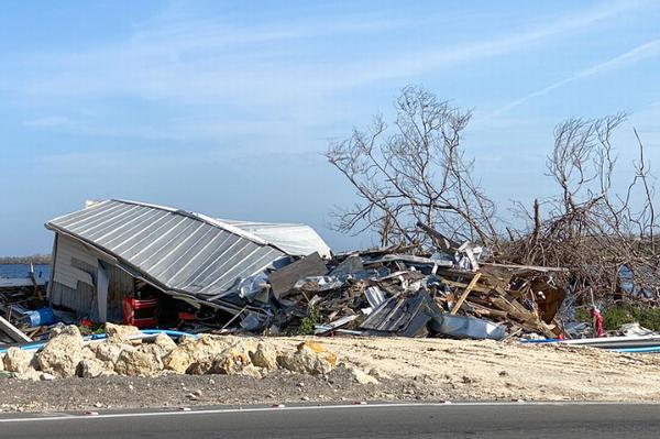
- NOAA Weather Prediction Center’s experimental Probabilistic Precipitation Portal provides user-friendly access to see the forecast for rain and flash flooding up to three days in advance. In 2024, Hurricane Helene caused more than 30 inches of extreme inland rainfall that was devastating and deadly to communities in North Carolina.
- NOAA’s outlook is for overall seasonal activity and is not a landfall forecast. NOAA also issued seasonal hurricane outlooks for the eastern Pacific and central Pacific hurricane basins. NOAA’s Climate Prediction Center will update the 2025 Atlantic seasonal outlook in early August, prior to the historical peak of the season.
Colorado State Scientists Make Parallel Forecast
Every year, the Department of Atmospheric Science at Colorado State University in Fort Collins creates a forecast of the upcoming hurricane season. Just like NOAA’s analysis, their 2025 forecast also warns of an above-average hurricane season this year.
“We anticipate that the 2025 Atlantic basin hurricane season will have above-normal activity. Current La Niña conditions are likely to transition to ENSO neutral conditions in the next couple of months; however, there remains considerable uncertainty as to what the phase of ENSO will be this summer and fall. Sea surface temperatures across the eastern and central Atlantic are generally warmer than normal, but not as warm as they were last year at this time,” wrote Colorado State senior research scientist Philip Klotzbach, Professor Michael Bell, and research scientist Levi Silvers in April.
A warmer-than-normal tropical Atlantic combined with a likely ENSO neutral, or a potential La Niña, typically provides a more conducive dynamic and thermodynamic environment for hurricane formation and intensification, the Colorado State scientists explain.
“We anticipate an above-average probability for major hurricanes making landfall along the continental United States coastline and in the Caribbean,” said Klotzbach and his colleagues. “As with all hurricane seasons, coastal residents are reminded that it only takes one hurricane making landfall to make it an active season. Thorough preparations should be made every season, regardless of predicted activity.”
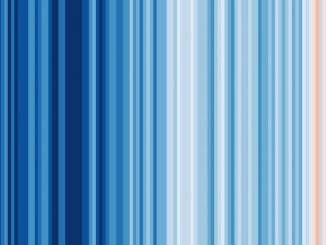
Hotter Climate Making Storms Worse
Global temperatures are expected to continue at or near record levels in the next five years, increasing climate risks and impacts on societies, economies and sustainable development, according to the WMO Global Annual to Decadal Climate Update (2025–2029).
The report forecasts that the annually averaged global mean near-surface temperature for each year between 2025 and 2029 will be between 1.2°C and 1.9°C higher than the average over the years 1850-1900.
There is an 80 percent chance that at least one year between 2025 and 2029 will be warmer than the warmest year on record – currently 2024. And there is an 86 percent chance that at least one year will be more than 1.5°C above the pre-industrial level. The report does not give global predictions for individual years.
Posted on April 15, 2025 by Dr. Robert Rohde, Dr. Zeke Hausfather, and Dr. Devin Rand of the nonprofit independent climate research organization Berkeley Earth, the following summary of global temperature conditions in Berkeley Earth’s analysis shows that March 2025 tied for the warmest March on record, with global average temperatures of 1.55 ± 0.15 °C (2.32 ± 0.22 °F) above the 1850-1900 average.
Temperatures were a touch warmer than March 2024 and March 2016 by 0.02 °C and 0.04 °C, respectively. Due to the overlapping uncertainties, these temperatures are essentially equal.
ENSO transitioned from La Niña to a neutral state. Neutral conditions will likely persist throughout the summer.
Lowest Arctic sea ice extent in the 47-year satellite record, beating the previous low set in 2017 by 150,000 square kilometers (58,000 square miles). The year 2025 now has a 34 percent chance to be the warmest year and 46 percent chance to be the second warmest year on record.
Using a high resolution approach, Berkeley Earth’s report estimates that 104 countries had their locally warmest year on record in 2024, including: Brazil, Canada, China, Mexico, Singapore, and South Korea. Given the distribution of record warmth in 2024, it’s estimated that 3.3 billion people – about 40 percent of the Earth’s population —live in places that experienced the warm local annual average in 2024.
Berkeley Earth estimates that 2025 will likely be the third warmest year on record, due to an expected cooling pattern in the Equatorial Pacific.
Recent rates of warming and grossly inadequate mitigation efforts make it clear that the 1.5 °C (2.7 °F) warming threshold established by the Paris Agreement will be surpassed, and the long-term average global warming will likely cross this threshold in the next five to10 years, Dr. Rohde estimates. “More aggressive efforts to reduce greenhouse gas emissions would be necessary to avoid even higher levels of warming and to mitigate more significant impacts from extreme weather events,” he said.
“Given the apparent increase in warming, and the uncertainty around future warming rates, the need for access to accurate and reliable data and modeling tools to inform adaptation and resilience planning is more important than ever,” said Berkeley Earth Executive Director Kristen Sissener. “We need to prioritize discussions around adapting to future warming alongside our continued work to urgently reduce greenhouse gas emissions.”
Featured image: Hurricane hunter aircraft heads into a storm. undated (Photo courtesy NOAA)
© 2025, Environment News Service. All rights reserved. Content may be quoted only with proper attribution and a direct link to the original article. Full reproduction is prohibited.