
WASHINGTON, DC, January 30, 2015 (ENS) – Considering the risk of rising sea levels due to climate change, President Barack Obama today issued the nation’s first Federal Flood Risk Management Standard for taxpayer-funded projects. He described the Standard as “a flexible framework to increase resilience against flooding and help preserve the natural values of floodplains.”
The new flood standard will apply when federal funds are used to build, retrofit or repair structures and facilities in and around floodplains to ensure that those structures are resilient, safer, and long-lasting.
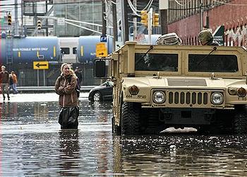
More than 50 percent of Americans live in coastal counties, where key infrastructure and evacuation routes are increasingly vulnerable to impacts like higher sea levels, storm surges, and flooding, the White House Council on Environmental Quality said today.
According to the National Climate Assessment, more than $1 trillion of property and structures in the United States are at risk of inundation from sea level rise of two feet above current sea level – an elevation that could be reached as early as 2050.
Incorporating the new standard will ensure that agencies expand management from the current base flood level to a higher vertical elevation and corresponding horizontal floodplain to address current and future flood risk.
By Executive Order, President Obama established the new flood standard and outlined a process for requesting and considering of public input, including from governors, mayors, and other stakeholders, before the standard is implemented.
Once public input has been considered, including from a series of public listening sessions to be held across the country, and the guidelines are finalized, agencies will implement the Standard through their own rulemaking or other procedures, which also will incorporate input from the public and stakeholders.
It will not affect the standards or rates of the National Flood Insurance Program. Each agency will carefully consider how to appropriately apply this standard, and consider robust public input before deciding how to implement it.
To protect their homes, businesses and vital infrastructure from disasters, at least 350 communities across the country, from Dallas and Nashville to Denver and Tulsa, and the states of Indiana, Montana, New York and Wisconsin have already adopted standards that either meet or exceed this new Federal standard.
In 2013, the President’s Hurricane Sandy Rebuilding Task Force adopted a higher flood standard for the Sandy-affected region to ensure that Federally funded buildings, roads and other projects were rebuilt stronger to withstand future storms.
The newly strengthened Federal Flood Risk Management Standard is similar to flood risk standards in place in the states of New York and New Jersey.
The Sandy Task Force also recommended that the federal government create a national flood risk standard for Federally funded projects beyond the Sandy-affected region.
In the President’s Climate Action Plan, he followed through on this recommendation by directing agencies to update their flood-risk reduction standard to ensure that federally funded projects across the country last as long as they are intended.
Over the past year, federal agencies collaborated on this update. The new standard announced today gives agencies the flexibility to select one of three approaches for establishing the flood elevation and hazard area they use in siting, design, and construction.
They can:
• Use data and methods informed by best-available, actionable climate science;
• Build two feet above the 100-year (1%-annual-chance) flood elevation for standard projects, and three feet above for critical buildings like hospitals and evacuation centers; or
• Build to the 500-year (0.2%-annual-chance) flood elevation.
The Administration today also released proposed guidelines, which will be available for 60 days of public comment. When finalized they will provide guidance to agencies on implementing the new standard.
Each agency shall, in consultation with the Water Resources Council, Federal Interagency Floodplain Management Task Force, Federal Emergency Management Agency, and Council on Environmental Quality, issue or amend existing regulations and procedures to comply with the Executive Order.
Copyright Environment News Service (ENS) 2015. All rights reserved.
© 2015, Environment News Service. All rights reserved. Content may be quoted only with proper attribution and a direct link to the original article. Full reproduction is prohibited.