
ABU DHABI, United Arab Emirates, December 13, 2013 (ENS) – Pushed by population growth, water scarcity and climate change, the pace of environmental change in the Arab region is accelerating, finds new research released by the United Nations and the Abu Dhabi government in the form of an atlas.
The UN Environment Programme and the Abu Dhabi Global Environmental Data Initiative, supported by the Environment Agency – Abu Dhabi, this week released “The Arab Region: Atlas of Our Changing Environment,” which examines environmental changes over the past 50 years.

The Arab region, a group of 22 member countries of the League of Arab States sharing a common language, culture and religion, is divided into three contiguous clusters on two continents and in two hemispheres, bordering on five oceans and seas. Stretching across 14 million square kilometers, the region covers nine percent of the Earth’s total land area, with a population of over 350 million, more than half of whom live in cities.
The first report of its kind on the Arab Region, the atlas examines the environmental change that has taken place at more than 80 locations, with current and historical satellite images, maps and photographs, and a narrative based on extensive scientific evidence.
Before-and-after studies demonstrate wide-ranging land use change, urban growth, degradation of marine and coastal areas, altered hydrology and shrinking water bodies, loss of habitats and the impacts of climate change.
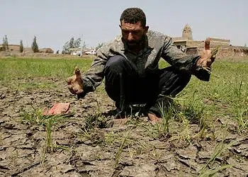
Water scarcity is a key environmental issue in 19 of the 22 countries in the region. Very low and highly variable annual rainfall makes the region particularly vulnerable to climate change impacts, and per-capita water availability is expected to be cut in half by 2050.
Today, only 14.5 percent of the region’s total land area is arable. Placing these limited arable lands at further risk, desertification and land degradation afflicts 17 of the Arab countries, triggering transboundary issues such as food insecurity and human migration.

Biodiversity is declining due to habitat degradation and loss. The total number of known threatened species in the region stands at 1,746, with a majority of them classed as Critically Endangered.
Many of these major issues are interrelated and most are a direct consequence of increasing populations and environmental conditions associated with climate change. The arid to hyper-arid climate is plagued by frequent drought, which is the region’s most pressing natural hazard.
The Arab region has faced 276 disaster events in the past 25 years – more than 40 percent of them during the past five years.
Before that, between 1980 and 2008, droughts, earthquakes, floods and storms affected more than 37 million people in the region and caused damage estimated at US$20 billion.
The atlas brings to light stories of these environmental changes through images showing visual evidence of changes taking place in the land, water and atmosphere, and covering transboundary issues like river basins, transboundary conservation areas and pollutants.
It illustrates how humans have altered their surroundings and continue to make observable and measurable environmental changes to the region – both negative and positive.

Many Arab nations have established special institutions for environmental management and sustainable development, and improvements in health and education create building blocks for accelerating this sustainable development.
Progress towards achieving environmental sustainability under the United Nations’ Millennium Development Goal No. 7, Ensuring Environmental Sustainability, is tracked from 1990 to present using five indicators: proportion of forested lands, number of urban slum dwellers, access to improved water sources, access to improved sanitation and proportion of protected areas.
Though progress has been made towards meeting targets for some of these indicators, it has been slow and uneven across the Arab countries. Obstacles include shortcomings in aid or assistance, the current global economic crisis, local environmental conditions brought about by climate change and lack of effective governance.
With paired satellite images covering each of the Arab countries, the atlas provides visual evidence of landscape changes, such as the greening of the desert and increased irrigated agriculture; expansion of oil fields; deforestation and vegetation loss, insect infestations or harvesting for fuelwood; unchecked urbanization, development of coastal areas and impacts from severe weather events.

The development of mega-cities in the Arab region is one of the most striking impressions in the atlas. Cairo, Algiers, Beirut, Casablanca, Amman, Sana’a and Riyadh have all experienced extensive and rapid development of their urban areas.
Coastal developments such as Mesaieed Industrial City in Qatar, Aden in Yemen, and Saudi Arabia’s Qatif and Tarut Islands have transformed the coastal and marine environments bringing oil pollution, destruction of coral reefs, mangroves and seagrass ecosystems along with development.
The greening of the desert shown in the UAE’s Al Ain and at the Kuwait-Iraq Separation Border testify to efforts to improve environmental conditions and conserve water resources.
Wafra Farms in Kuwait has expanded their food production to include aquaculture of Nile tilapia in order to supplement the fish industry, and has established greenhouses to improve crop production.
Greenhouse agriculture has been implemented on a large scale in Syria. The growth of this controlled agriculture was prompted by recurring drought, the need to improve agricultural efficiency and meet increased demands for food production internally and abroad, with the least possible environmental impact.
The Taparura Project in Sfax, Tunisia, is an example of projects in the region to revive urban areas and reintegrate their coastlines.
Perhaps the most compelling story of environmental change is the revitalization of the Mesopotamian Marshlands, which suffered a tragic loss of wetlands from 1950 through 1990.
The atlas is the latest addition to a series of atlases coordinated by UNEP that began in 2005 with the launch of a global atlas – “One Planet, Many People.” This new atlas is an important addition to the growing suite of UNEP atlases that aim to contribute to a better understanding of the dynamics of environmental change.
Copyright Environment News Service (ENS) 2013. All rights reserved.
© 2013, Environment News Service. All rights reserved. Content may be quoted only with proper attribution and a direct link to the original article. Full reproduction is prohibited.