
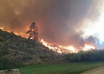
MOFFETT FIELD, California, August 22, 2014 (ENS) – Reuben Cummings from Peoria, Illinois is designing a web application to map potential and actual climate-related environmental hazards such as wildfires, flood, and drought across the United States.
His is one of four ideas NASA has selected from those submitted by the public for innovative uses of climate projections and Earth-observing satellite data. The four citizens will share a $10,000 prize.
The agency also has announced a follow-on challenge with awards of $50,000 to build climate applications based on OpenNEX data on the Amazon cloud computing platform.
“Our second challenge seeks to rapidly turn these ideas into practical applications,” said Ramakrishna Nemani, principal scientist for the NEX project at NASA’s Ames Research Center in Moffett Field, California.

Both challenges use the Open NASA Earth Exchange, or OpenNEX, a data, cloud computing, and knowledge platform where users can share modeling and analysis codes, scientific results, information and expertise to solve big data challenges in the Earth sciences.
OpenNEX provides users a large collection of climate and Earth science satellite data sets, including global land surface images, vegetation conditions, climate observations and climate projections.
The four winners of the “ideation” stage of the OpenNEX challenge, which ran from July 1 through August 1, will share a $10,000 award for their ideas on novel uses of the datasets.
The other three winners are:
Abdal Elhassani of Indiana University, Bloomington, who proposed an app to predict how plant hardiness zones will change with a changing climate.
Edward Aboufadel of Grand Valley State University in Allendale, Michigan, suggested using the data to compare a local community’s future predicted climate with the historical record of another community.
A team led by Raymond Milowski of San Francisco, who proposed converting OpenNEX climate model data to formats compatible with the Open Web Platform to facilitate wider use by web developers.
The second “builder” challenge that opens today offers awards for the development of an application or algorithm that communicates climate change impacts to the general public using the OpenNEX data.
Submissions based on the winning proposals in the “ideation” challenge are encouraged, in addition to new ideas that focus on climate change impacts.
Applications should communicate through concise summaries of impacts over time that rely on key climatic events or observable events dependent on climate, such as changes in the timing of snow melt and runoff, plant flowering and the start of the allergy season, and the annual migration of birds.
“NASA is committed to engaging and enabling individuals and groups to make use of these high-quality scientific data and innovative technologies to better communicate climate change impacts to the general public,” said Tsengdar Lee, program manager in the Earth Science Division of the Science Mission Directorate at NASA Headquarters in Washington.
Entries are due by October 21 and NASA plans to announce the winners on December 15.
NASA’s OpenNEX challenge ties in to White House data initiatives, including Open Data, Big Data and Climate Data. These initiatives advance national goals to address climate change impacts on economic growth, health and livelihood, and include the use of competitions and challenges to foster regional innovation.
The challenges are managed by NASA’s Center of Excellence for Collaborative Innovation, established in coordination with the White House Office of Science and Technology Policy.
To educate citizen scientists about how the data on OpenNEX can be used, NASA has created a series of online video lectures and hands-on lab modules. To view the videos, and for information on registering for the challenges, visit: https://nex.nasa.gov/OpenNEX
Copyright Environment News Service (ENS) 2014. All rights reserved.
© 2014, Environment News Service. All rights reserved. Content may be quoted only with proper attribution and a direct link to the original article. Full reproduction is prohibited.