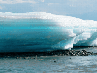
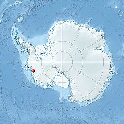
ST. PETERSBURG, Florida, September 8, 2022 (ENS) – The Thwaites Glacier in West Antarctica, a vast glacier about the size of Florida, is already in a phase of fast retreat in a warming world, causing widespread concern among scientists about how quickly it may dissolve its millions of tons of ice into the ocean, raising global sea levels by as much as two feet.
The Thwaites Ice Shelf, a floating ice shelf which braces and restrains the eastern portion of Thwaites Glacier, could collapse, a new study shows. If this ice shelf does collapse, the impact of its retreat could be “up to 65 centimeters (25 inches) of global sea-level rise,” an international team of scientists has determined.
Their study, published this week in the current issue of the journal “Nature Geosciences” states, “Ice loss from West Antarctica’s second largest marine ice stream, Thwaites Glacier, is currently a major uncertainty for future sea-level projections. Its bed deepens upstream to more than 2 km below sea level, and warm, dense, deep water delivers heat to the present-day ice-shelf cavity, melting its ice shelves from below.”
“These conditions make Thwaites Glacier susceptible to runaway retreat,” the authors state.
That much sea level rise means cities like Miami and Fort Lauderdale, Florida, and Galveston, Texas that see nuisance flooding during high tides today will experience much more damaging floods by midcentury.
“Just a small kick to Thwaites could lead to a big response,” warned lead author Dr. Alistair Graham from the College of Marine Science, University of South Florida in St Petersburg.
For the first time, scientists have mapped in high-resolution a critical area of the seafloor in front of the Thwaites Glacier that gives them a window into how fast the glacier has retreated in the past.
The summer of 2019 was an unusual Antarctic summer, notable for its lack of sea ice. This allowed an international team of scientists to access the glacier’s front for the first time in history.
To collect the imagery and geophysical data, scientists from the United States, the United Kingdom, and Sweden launched a state-of-the-art orange robotic vehicle loaded with imaging sensors that summer. Operated by scientists at the University of Gothenburg in Sweden, the vessel embarked on a risky 20-hour mission – it mapped an area of the seabed in front of the glacier about the size of the city of Houston, Texas.
Co-author Anna Wåhlin, a physical oceanographer from the University of Gothenburg who deployed the robotic vehicle at Thwaites, said, “This was a pioneering study of the ocean floor, made possible by recent technological advancements in autonomous ocean mapping and a bold decision by the Wallenberg Foundation to invest into this research infrastructure. The images … collected give us vital insights into the processes happening at the critical junction between the glacier and the ocean today.”
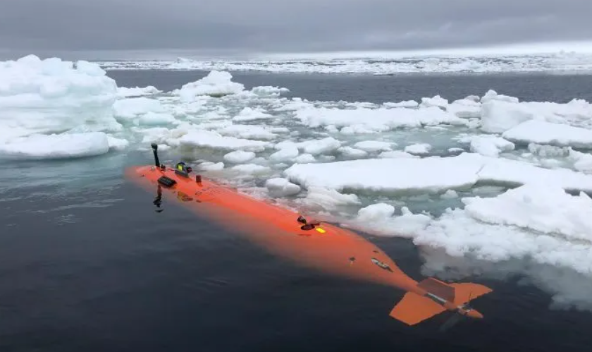
“It was truly a once in a lifetime mission,” said Graham, who said the team would like to sample the seabed sediments directly so they can more accurately date the ridge-like features. “But the ice closed in on us pretty quickly and we had to leave before we could do that on this expedition,” he said.
To understand Thwaites’ past retreat, the team analyzed the rib-like formations submerged 700 meters (about half a mile) beneath the polar ocean. They factored in the tidal cycle for the region, as predicted by computer models, to show that one ‘rib’ must have been formed every single day. The team documented more than 160 parallel ridges that were created, like a footprint, as the glacier’s leading edge retreated and moved up and down with the daily tides.
At some point in the last 200 years, over a duration of less than six months, the front of the glacier lost contact with a seabed ridge and retreated at a rate of more than 2.1 kilometers per year (1.3 miles per year) – twice the rate documented using satellites between 2011 and 2019.
Graham said, “Our results suggest that pulses of very rapid retreat have occurred at Thwaites Glacier in the last two centuries, and possibly as recently as the mid-20th century.”
While many questions remain, one thing’s for sure: it used to be that scientists thought of the Antarctic ice sheets as sluggish and slow to respond, but that’s simply not true, said Graham.
Marine geophysicist and study co-author, Dr. Robert Larter, from the British Antarctic Survey, said, “Thwaites is really holding on today by its fingernails, and we should expect to see big changes over small timescales in the future – even from one year to the next – once the glacier retreats beyond a shallow ridge in its bed.”
“The stunning imagery shows geologic features that are new to science, and also provides a kind of crystal ball to see into Thwaites’ future,” he said.
According to the United Nations, roughly 40 percent of the human population lives within 60 miles of a coastline somewhere in the world.
“This study is part of a cross-disciplinary collective effort to understand the Thwaites Glacier system better,” said Tom Frazer, dean of the College of Marine Science, University of South Florida, “and just because it’s out of sight, we can’t have Thwaites out of mind. This study is an important step forward in providing essential information to inform global planning efforts.”
The study was supported by the National Science Foundation and the UK Natural Environment Research Council through the International Thwaites Glacier Collaboration. The 2019 expedition was the first in a five-year project dubbed THOR, which stands for Thwaites Offshore Research, and also included team members from a sister project called the Thwaites-Amundsen Regional Survey and Network Integrating Atmosphere-Ice-Ocean Processes, or TARSAN.
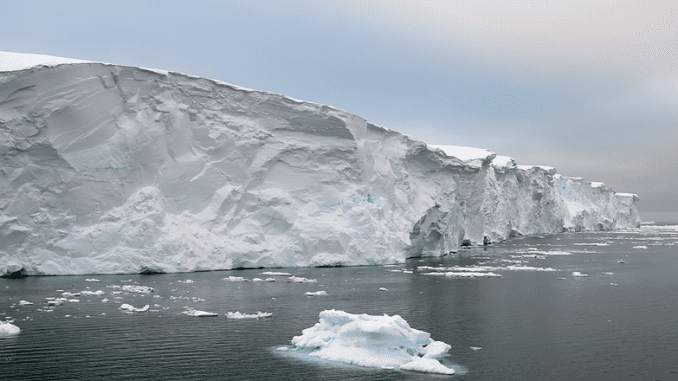
Featured image: Thwaites Glacier, West Antarctica, 2019, (Photo courtesy Rice University Earth, Environmental and Planetary Sciences)
© 2022, Environment News Service. All rights reserved. Content may be quoted only with proper attribution and a direct link to the original article. Full reproduction is prohibited.