WASHINGTON, DC, April 27, 2020 (ENS) – Ten of the world’s largest palm oil producers and buyers are collaborating to support and fund the development of a new, publicly-available, radar-based forest monitoring system known as Radar Alerts for Detecting Deforestation, RADD.
This partnership includes Bunge, Cargill, Golden Agri-Resources, Mondelēz International, Musim Mas, Nestlé, Pepsico, Sime Darby Plantation, Unilever, and Wilmar. They believe the new monitoring system will make it easier for companies and other stakeholders to see deforestation happening in near-real-time and with greater accuracy than they can today.
With this information, the companies say they can more quickly mobilize follow-up actions on the ground and work to improve the sustainability of commodity supply chains.
“Cargill is committed to working with industry partners to spur innovation and drive meaningful change to end deforestation,” said John Hartmann, Cargill’s agriculture supply chain sustainability lead. “We are delighted about RADD’s introduction to the palm oil sector and look forward to developing credible, real-time data that is publicly accessible to enhance our ability to act on deforestation alerts.”
A high rate of forest loss due to human activities combined with more frequent extreme climate events is increasing the pressure on the Earth’s forest ecosystems. At the same time, countries and major commodity sectors are committing to zero-deforestation pledges.
These circumstances make it urgent to obtain accessible and timely information on the dynamics and drivers of changes in forests to empower sustainable land management and law enforcement actions against illegal logging and poaching.
Palm oil is a type of vegetable oil made from the fruit of the African oil palm tree, which originates in West Africa. It can be grown in any humid tropical climate and has taken a strong foothold in Indonesia and Malaysia and on the island of Borneo.
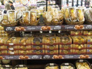
Palm oil is in roughly half of all household and food products sold in western countries. It is found in shampoo, toothpaste, detergent, frozen microwave dinners, cookies, peanut butter, margarine, skin lotion, and cosmetics. It is used to replace dairy ingredients in foods intended for people allergic to milk products.
Palm oil tastes good and is convenient, but the clearing of native forests to plant oil palms is the leading cause of the extinction of orangutans. Orangutans are the most arboreal of the great apes and spend most of their time in trees. They are among the most intelligent primates and have been studied for their learning abilities.
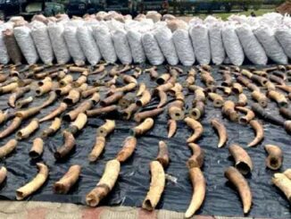
The primary threat to orangutans is the loss of habitat through deforestation for palm oil plantations as well as fires set to clear land. Up to 80 percent of the forest in Indonesia and Malaysia suitable for orangutan habitat has been lost in the past 20 years. Destruction of the rainforest also enables the illegal pet trade and poaching, according to Borneo Orangutan Survival Australia.

Sepilok, Sabah, Borneo. (Photo by Carine06)
Most recent estimates indicate that around 15,000 Sumatran orangutans and 57,000 Bornean orangutans survive in the wild today. There is a debate as to the rate of population decline, says BOS Australia, but still, recent estimates suggest a loss of between 3,000 and 5,000 orangutans every year.
Dr. Simon Lord, is the chief sustainability officer of Malaysia’s Sime Darby Plantation, the world’s largest palm oil planter and one of the 10 collaborators supporting RAAD.
“People around the world are concerned about the rapid rate of deforestation and regrettably the oil palm industry is often associated with it,” said Lord. “As producers of sustainable palm oil, Sime Darby Plantation understands this concern and believes that traceability in our supply chain is necessary to draw the line on deforestation.”
“Change requires an industry-wide effort. We believe that working together with like-minded partners on the development of RADD will ensure we move towards a sustainable future for our world and the industry,” Lord said.
Developed by The Netherlands’ Wageningen University and Satelligence, a Netherlands-based remote imaging company. and facilitated by the U.S.-based World Resources Institute, the RADD system will augment existing publicly available monitoring tools that rely on optical-based satellite imagery, which can be delayed when clouds obstruct the view of forests.
Through the use of radar waves, the new RADD system can penetrate cloud cover and gather forest change information without obstruction by clouds or sunlight.
The researchers aim to use the new radar sensors to monitor dynamics in forest landscapes at global scale, high spatial resolution, and in near real-time.
The RADD system is currently being developed for Indonesia and Malaysia. Preliminary results for two countries indicate that the new RADD system can detect tropical deforestation several weeks earlier than optical-based systems.
What makes RADD unique is that it is the first radar-based monitoring system of this scale that will make deforestation alerts publicly available.
Once the system is complete, the alerts will be available on Global Forest Watch and Global Forest Watch Pro, and the methodology behind the alerts will be published.

The new system will utilize freely available radar data from the European Space Agency’s Sentinel-1A and B satellites, which orbit the Earth every six to 12 days. These satellites provide high spatial detail that will improve the detection of smaller forest-clearing events.
Throughout the RADD system development over the next two years, partner companies will receive alerts about detected deforestation events and will provide crucial feedback to improve the system.
The open nature of the system will enable companies – plus governments, civil society organizations, and concerned stakeholders – to monitor forests using the same information source and standards.
Benjamin Ware, global head of responsible sourcing at the largest food company in the world, the Swiss multinational Nestlé, said, “We take an integrated approach in addressing the risks of deforestation, combining tools like certification, supply chain mapping, on-the-ground verification, and satellite monitoring. We are pleased to support the development of a publicly available forest monitoring system like RADD as it will bring accountability and transparency across the industry.”
“We’re thrilled to see a major group of companies coming together in this way to create a collective change,” said Anne Rosenbarger, commodities manager with the World Resources Institute. “Uniting around this shared, cutting-edge monitoring system will allow for more efficient use of resources, create more streamlined conditions for companies to follow up, and ultimately help prevent further deforestation.”
Copyright Environment News Service (ENS) 2020. All rights reserved.
© 2020, Environment News Service. All rights reserved. Content may be quoted only with proper attribution and a direct link to the original article. Full reproduction is prohibited.