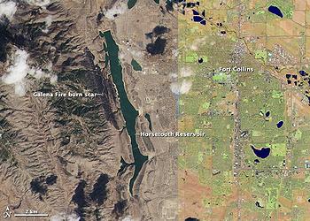
WASHINGTON, DC, August 8, 2013 (ENS) – Landsat satellites orbiting the Earth have continuously recorded changes to the planet’s land surfaces for 40 years, but while it is essential to U.S. national security, the future of the program is now in jeopardy, warns a new report from the National Research Council.
The committee that wrote the report warned that while the United States pioneered frequent-repeat global imaging, “other nations are now developing systems whose capability rivals or exceeds U.S. systems.”
“National needs require the United States to reassert leadership and maintain and expand capabilities,” the committee wrote. “Space-based land imaging is essential to U.S. national security as it is a critical resource for ensuring U.S. food, energy, health, environmental, and economic interests.”

“The economic, intrinsic, and scientific benefits to the United States of Landsat imagery far exceed the investment in the system,” the committee states in its report, “Landsat and Beyond: Sustaining and Enhancing the Nation’s Land Imaging Program.”
Chaired by Jeff Dozier, a professor at the Bren School of Environmental Science and Management at the University of California, Santa Barbara, the committee includes experts in satellite imaging and remote sensing from across the country, including former NASA scientists and officials.
The committee’s primary recommendation is that the federal government establish a sustained and enhanced land imaging program with an overarching national strategy and long-term commitment, including clearly defined program requirements, management responsibilities, and persistent funding.
Beginning with the 1972 NASA launch of the Earth Resources Technology Satellite, later renamed Landsat 1, and continuing with the February 2013 launch of Landsat 8, the United States has amassed a sustained satellite record of land remote sensing data.
Landsat data and imagery have helped to advance understanding and management of key national interests such as agriculture, forestry, hydrology, urbanization, homeland security, disaster mitigation, and climate change.

NASA says, “The data from the Landsat spacecraft constitute the longest record of the Earth’s continental surfaces as seen from space.”
Researchers use the 40 year data record to document effects of climate variability, invasive species, and land use that have no direct analog in past events and can better differentiate between short-term variability and longer-term trends.
But the satellites that support this mission have limited lifespans. The Landsat 7, launched in 1999, is operating in a degraded mode, and the most recent satellite, Landsat 8, was launched in February 2013 with only a five-year design life.
While Landsat 9 is under discussion, its program missions are unclear, management responsibilities have not been articulated, and no budget has been appropriated, the committee found.
The National Research Council report concludes that a continued program will not be viable under the current mission development and management practices.
“The continuity of Landsat imagery has never been ensured through the development of a sustained government program. Instead, responsibility has been shifted from one organization to another over Landsat’s 40-year history, resulting in persistent uncertainty for the future of this important asset,” states the report.
The committee says NASA has demonstrated that it is the civil agency with the technical capacity and the congressional support to design and build civilian space missions.
The USGS-operated data management and distribution systems function effectively and efficiently.
Building a satellite sequence with new requirements and technologies for each individual instrument is an expensive way to acquire land imaging data and inhibits the addition of new capabilities, says the committee.

Instead, the committee advises that the federal government develop a plan for a comprehensive, integrated program that capitalizes on the strengths of USGS and NASA, maintains current capability and the existing archive, and enhances the program as technology enables new imaging capabilities and data products.
The government needs to ensure acquisition of land imaging data continuously from orbital platforms, and periodically from airborne platforms, to respond to the needs of producers and consumers of derived data products along with users who analyze imagery.
The U.S. government should establish partnerships with commercial firms and international land imaging programs to leverage enhanced capabilities, and coordinate land imaging data buys across federal government agencies, the committee advises.
Any future program should include a research and development component to improve data products based on core measurements, to develop new measurement methods and to consider evolving requirements.
While the report does not recommend who should oversee the program, which is currently managed jointly by the U.S. Geological Survey and NASA, it outlines key elements of a successful program regardless of where the federal government decides it should reside.
The committee says the core scientific and operational requirement for a future program is “the capture and distribution of global data that is calibrated to allow the comparison of future land images with previous collections, easily accessible by all users, and free.”
Since May 30, USGS specialists have been collecting at least 400 Landsat 8 scenes every day from around the world to be processed and archived at the USGS Earth Resources Observation and Science Center in Sioux Falls, South Dakota. Since 2008, USGS has provided more than 11 million current and historical Landsat images free of charge to users over the Internet.
“We are very pleased to work with NASA for the good of science and the American people,” said U.S. Interior Secretary Sally Jewell in Washington as Landsat 8 began to collect images. “The Landsat program allows us all to have a common, easily accessible view of our planet. This is the starting point for a shared understanding of the environmental challenges we face.”
Copyright Environment News Service (ENS) 2013. All rights reserved.
© 2013, Environment News Service. All rights reserved. Content may be quoted only with proper attribution and a direct link to the original article. Full reproduction is prohibited.
